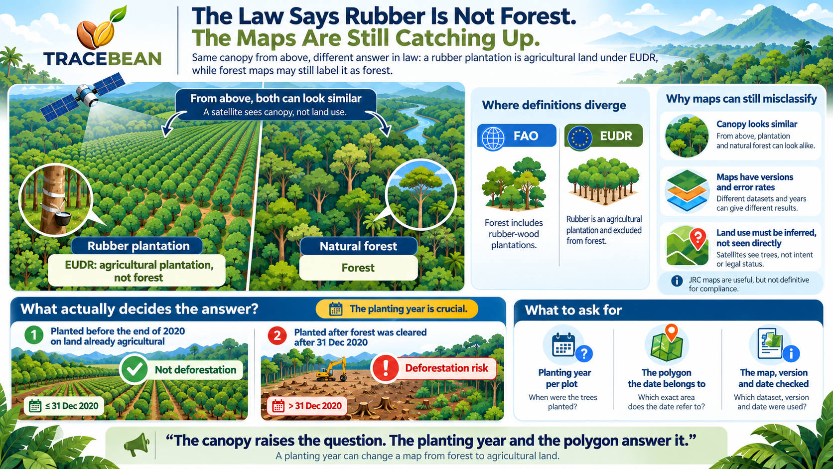
A rubber plantation is not forest under EUDR. That sounds like a technicality until you ask what it decides. A plantation that stood on agricultural land at the end of 2020 is not deforestation. A rubber plantation planted on cleared forest after that date is. What matters is what the land was on 31 December 2020, and the answer has to come from somewhere other than the canopy.
What the Commission says
The Commission's FAQ (version 5, April 2026) addresses rubber directly in question 4.14:
"Yes, rubber cultivation falls within the definition of 'agricultural plantation' under the Regulation... This definition includes all plantations of relevant commodities other than wood. Agricultural plantations are excluded from the definition of 'forest'. This means that the replacement of a forest with a rubber plantation would be considered as deforestation under the Regulation."
Commission FAQ on the implementation of the EUDR, v5, Q4.14
The same position carries into the Commission's own map. In question 9.10.1 the FAQ says the global forest cover map for 2020 (GFC2020) follows the EUDR definition of forest, and that "all plantations of relevant commodities other than wood, i.e. cocoa, coffee, oil palm, rubber, and soya, are excluded from forest." So in principle a rubber plantation should be absent from that map. Whether it always is, is a different matter.
Where the definitions pull apart
EUDR does not invent its own forest definition. The FAQ (4.13) says the regulation relies on the definition of the Food and Agriculture Organization. The thresholds are the familiar ones: more than 0.5 hectares, trees higher than 5 metres, canopy cover above 10%. Where the two texts differ is rubber.
The producers' side has not been silent on this. In October 2023 the Association of Natural Rubber Producing Countries (ANRPC) asked the EU to recognise rubber as a "forest tree", according to the European Rubber Journal. We did not find a more recent ANRPC statement on this specific point, and the Commission's FAQ today reads the other way. Whatever one thinks of the outcome, the practical result is the same for an operator: the rule is settled, the map is not.
What a satellite sees
A rubber stand and a natural forest can look alike from orbit: dense canopy, taller than 5 metres, well above 10% cover. Land use is not in the pixels. It has to be inferred from texture, planting patterns, outside datasets or a field visit. We wrote about the same weakness with shade-grown coffee, and about why a tree-cover signal is a question, not a verdict.
The JRC, which produces the Commission's maps, is open about it. In the peer-review exchange for the paper on its 2020 forest cover map, the authors write that future updates may "potentially lower commission errors linked to current misclassification of cocoa, coffee, oil palm or rubber", and that in Africa the commission error "is primarily driven by confusion between forest and agricultural tree plantations or agroforestry systems". The same discussion version reports an overall commission error of 18% and omission of 8%, and an Africa commission error of 24.6 ± 3.1%. These figures come from the discussion draft, not necessarily the final paper or the current map version, and they are not specific to rubber.
Commission error means the map shows forest where there is none. For an operator that is not a harmless mistake: it is a flag on land that may be perfectly compliant.
Two maps, several versions
It is also worth knowing which map is being read. The forest cover map exists in several versions, and the FAQ points readers to version 3 of December 2025, with overall accuracy "above 92%". A second map, the forest types map GFT2020, came out in version 1 in January 2026 and divides forest into primary, naturally regenerating and "planted forest (including plantation forest)". The Commission describes both as non-binding and says neither is "intended as definitive source of information for compliance".
As we read it, a rubber plantation should appear in neither as forest, since the law counts it as an agricultural plantation. How often one slips through in either map is an accuracy question, not a legal one, and the JRC authors themselves name rubber among the crops the forest cover map has misclassified. We are testing how the two maps treat plantation land against imagery and will report back once the results hold up. Until then, an operator who uses these maps should record which map, which version and which date it used. A result without that is hard to repeat and harder to defend.
The one fact that settles it
The JRC authors give the answer themselves, in a different context: "The year of planting for tree crops is indeed a crucial piece of information", and it is not consistently available. For rubber the logic is simple. If the stand was planted before the end of 2020 on land that was already agricultural, it is not deforestation. If it was planted afterwards on land that was forest in 2020, it is. The same canopy, two opposite answers, and only the planting date separates them.
It also helps with replanting. A rubber stand that is felled and replanted at the end of its productive life will show as tree-cover loss followed by regrowth in a change dataset. As we read it, that is not deforestation, because the land was never forest in the legal sense. Without a planting date, though, the loss looks the same as clearing.
What to ask for
- Planting year per plot, not per supplier. A single date for a whole cooperative cannot separate a 2008 stand from a 2022 one.
- The polygon the date belongs to. A planting year for the wrong piece of land is worse than none.
- The map and version you checked against, and the date you checked.
None of this is specific to rubber. Coffee, cocoa, oil palm and soy are in the same list of commodities whose plantations the law excludes from forest, and the same arithmetic applies to each: the canopy raises the question, the planting date and the polygon answer it.
TraceBean does not classify land use and does not issue compliance verdicts. We check that the polygon a planting date or a risk flag refers to is correct: valid geometry, coordinates inside the stated country, no duplicates or overlaps, and consistent formats and coordinate systems.
A planting year attached to the wrong polygon, or a map checked against the wrong place, answers a question nobody asked.
Sources: Commission FAQ on the implementation of the EUDR, version 5 (April 2026), questions 4.13, 4.14, 9.10.1, 9.10.2 and 9.10.5; FAO, Global Forest Resources Assessment 2020, Terms and definitions; Bourgoin et al., Global map of forest cover 2020 (ESSD discussion) and the authors' replies in that exchange; EC JRC Global Map of Forest Types 2020, V1; JRC Global Forest Cover 2020; European Rubber Journal, ANRPC voices 'deep concern' over EU deforestation regulation (17 October 2023).
← Back to Blog