The most common answer isn't "no"
Raise the topic of farm geo-data with an EU importer and the reply is rarely disinterest. It's usually some version of: we already have this handled, we've got our own system, good luck out there. Said with genuine confidence, not defensiveness. And often it's not wrong — plenty of operators have invested real money and real years into collecting coordinates from their supplier base.
The problem isn't the claim. It's that "handled" is doing a lot of quiet work in that sentence, covering ground it may or may not actually reach.
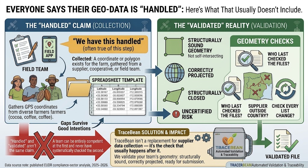
Collected and validated are two different claims
Ask what "handled" means in practice, and it almost always turns out to describe collection: a field app, a spreadsheet template, a cooperative liaison who gathers GPS points from farmers. That's real, necessary work, and it's the part of the problem most visible from inside an origin-sourcing team. It's also a different problem from validation — whether the coordinates that got collected are geometrically sound, correctly projected, structurally closed, and located inside the country they're declared to be in.
A team can be entirely competent at the first and never have systematically checked the second. Nothing about running a good supplier-engagement program guarantees anyone downstream opened the resulting files and checked whether the polygons close properly or the coordinates survived a CRS conversion intact.
Why the gap survives good intentions
This isn't a story about anyone cutting corners. Industry commentary on building traceability capability in-house is consistent on this point: the challenge isn't getting started, it's the ongoing cost of maintaining the technical expertise to keep checking data quality as supplier lists grow and rotate. A collection process built two years ago by a team that has since moved on to other priorities doesn't stop collecting — it just quietly stops being checked.
The scale of the underlying problem doesn't help. Independent estimates put the share of smallholder farms globally without any digital geolocation mapping above 80%. Every operator sourcing from smallholder cooperatives is, to some degree, building a collection process from a low base — which makes it easy for "we're collecting data now" to feel like the finish line, when it's closer to the starting one.
"We have this handled" is usually a true statement about collection and an untested one about validation. The two get conflated because, from a spreadsheet, a bad polygon and a good one look identical.
Three questions worth asking before taking "handled" at face value
None of these questions challenge whether an operator has invested in geo-data. They're aimed at a narrower, more answerable thing: whether the investment already made covers the specific structural checks a DDS submission depends on, or whether it stops one step short of them.
TraceBean isn't a replacement for supplier data collection — it's the check that usually happens after it, whether or not anyone has been running it consistently. We validate the geometry your team, your field app, or your cooperative liaisons already collected: structurally sound, correctly projected, ready for submission.
"Handled" and "validated" aren't the same claim. It's worth knowing which one you're actually making before you find out at the point of filing.
Industry commentary on in-house traceability build costs and smallholder digital mapping coverage is drawn from published EUDR compliance-sector analysis, 2025–2026.
← Back to Blog